

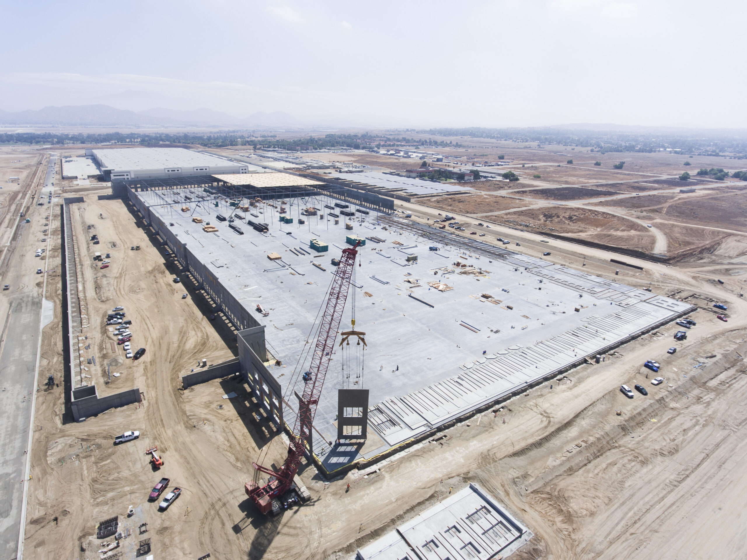
Your owner update is tomorrow. The superintendent has photos on a phone, a subcontractor emailed a few more, and nobody has a recent image showing how the entire site fits together.
Drone progress photos give construction managers a dated, wide-angle record they can use alongside schedules, field reports, and ground-level documentation. Their value comes from capturing useful views consistently and making those images easy to compare.
For Indianapolis construction teams, here’s how to make aerial photography part of a practical reporting routine.
Show owners what changed since the last update
An aerial overview can help an owner understand where work is happening without needing to interpret every line of a schedule. Repeat views make visible changes easier to follow: additional steel erected, another roof section installed, or paving extended into a new area.
For your next report, try pairing two images from the same viewpoint with a short explanation of what changed and what comes next. Use capture dates prominently. An image delivered Friday may have been photographed Tuesday, and that distinction matters when people discuss current conditions.
Keep progress statements grounded in your team’s records. A roof that looks complete from above may still have outstanding work.
Give coordination meetings a shared visual reference
Drone photos help put access roads, staging areas, building footprints, and adjacent work zones in the same frame. That context can make a coordination discussion easier to follow than several disconnected close-ups.
For example, a manager could mark a proposed delivery route on a copy of the latest overview, then ask the superintendent to confirm conditions on the ground. Label the markup as a proposal and retain the original image.
Photos can guide questions about space and sequencing. They still need the field team’s input, particularly when equipment, materials, or access conditions have changed since the flight.
Build a visual history you can actually find
A useful archive lets someone answer, “What did this area look like on that date?” without searching through hundreds of camera filenames. DroneDeploy’s construction photo documentation guidance emphasizes organizing images by time and location so teams can retrieve and share the relevant record.
A practical starting point is one folder per capture date, with consistent labels for each viewpoint. Keep original files, identify who captured them, and store annotated copies separately.
Combine aerial context with close-up ground photos where detail matters. A wide view may show where an excavation was open, while a ground image records something the aerial camera couldn’t resolve. Plan important captures before work gets covered.
Support reporting across multiple projects
If you’re overseeing several jobs, a consistent photo package makes each update easier to review. Ask for the same basic sequence every time: overall site, key elevations, active work zones, and agreed milestone details.
That structure gives a project executive a familiar way to review each location. It also helps you identify where a phone call or site visit would be useful.
Choose a small set of report-ready images rather than forwarding an entire flight’s output. Each selected photo should answer a question or illustrate a meaningful change.
Preserve material for project closeout and marketing
Progress coverage can also supply the beginning and middle of a project story. A finished-building photo becomes more informative when it’s paired with an earlier view showing the transformation.
If marketing use is part of the plan, tell the photographer before the first visit. Ask for consistent compositions and clarify image usage, client approval, and any restrictions on showing the site.
Red8 Media’s construction tracking services provide a starting point for discussing recurring coverage and the images your team needs throughout a project.
How often should you schedule drone progress photos?
Match the schedule to how quickly visible conditions change and when people need updates. These are planning suggestions, not fixed requirements:
- Weekly: Consider this during fast-moving exterior phases or when weekly reporting needs current visuals.
- Every two weeks: A possible fit when meaningful changes are visible between visits but weekly coverage adds little.
- Monthly: Consider this for broader owner updates or slower phases.
- At milestones: Add coverage around significant events, such as structural completion or a major site transformation.
Schedule delivery before the meeting the images will support. Leave room for weather adjustments, and flag critical milestones early so a routine visit doesn’t miss the moment you needed documented.
What should your photo package include?
Before requesting a quote, agree on these essentials:
- Repeatable viewpoints, with changes documented when site conditions require them.
- Capture dates and clear location labels.
- Full-resolution originals plus convenient files for reports.
- Coverage of the specific work areas your team wants to review.
- A delivery deadline and an agreed storage or sharing method.
- Clear terms for usage rights, access, and rescheduling.
Start with the reporting problem, then choose the deliverables. You may need ten carefully planned photos more than a cinematic video nobody has time to watch.
Know when you need more than progress photography
Progress photos are visual documentation. If your scope requires measured quantities, an orthomosaic, a 3D model, or inspection findings, specify those requirements separately, including accuracy expectations and the appropriate qualified professionals.
Autodesk’s construction drone case study describes workflows that process imagery into additional outputs. Those workflows illustrate why a photo delivery and a measurement deliverable shouldn’t be treated as interchangeable.
Planning construction drone photography in Indianapolis
Give your provider the site address, project phase, intended schedule, and site contact before setting flight dates. Ask how they’ll coordinate around crews, cranes, deliveries, and changing conditions.
Commercial drone work generally falls under the FAA’s Part 107 framework. The pilot should check the site’s airspace and obtain any required airspace authorization. Property access alone doesn’t resolve those requirements.
Planning recurring coverage for an Indianapolis-area project? Talk with Red8 Media about your construction progress photos. Share your location, timeline, and reporting needs so we can discuss coverage that gives your team a clearer picture from one update to the next.

Pingback: Marketing an Indianapolis Commercial Property? What Drone Photos and Virtual Tours Should Show - Red8 Media